Most of this “lollipop”-loop hike follows “single-track” multi-use trails recently constructed by the Palisades AmeriCorps trail crew of the New York-New Jersey Trail Conference, along with volunteers from the Palisades MTB (a mountain bike club). These multi-use trails are open to hikers, but they were designed primarily for mountain bikers and are heavily used by them. Although park...
Hike Description:
Most of this “lollipop”-loop hike follows “single-track” multi-use trails recently constructed by the Palisades AmeriCorps trail crew of the New York-New Jersey Trail Conference, along with volunteers from the Palisades MTB (a mountain bike club). These multi-use trails are open to hikers, but they were designed primarily for mountain bikers and are heavily used by them. Although park regulations provide that bicyclists must yield to hikers, hikers should be alert for approaching bicycles (both ahead and behind) on the “single-track” trails, and hikers may wish to step off the trail and permit bicyclists to pass them.
From the second (dirt) parking area, head east into the woods on a wide grassy path, following the yellow triangle blazes of the McKeags Meadow Connector Trail. After passing a locked gate, you’ll cross a causeway, with Laurel Meadow Pond on the left and a wetland on the right. Beyond the pond, the trail briefly climbs on a wide woods road, then continues to climb on a new “single-track” trail constructed by the Palisades AmeriCorps trail crew.
Soon, the McKeags Meadow Connector ends at a junction with the green-stripe-on-yellow-blazed McKeags Meadow Trail. Turn left onto the McKeags Meadow Trail, which begins a gradual descent, passing a huge boulder on the right. The trail proceeds north past Laurel Meadow Pond, visible through the trees on the left, then climbs on switchbacks.
At the top of the climb, you’ll come to a T-intersection. Here, the McKeags Meadow Trail turns sharply right, but you should turn left onto the Augusta Mine Trail, marked with green-dot-on-white blazes. This trail was constructed in 2022 by volunteers from the Palisades MTB, along with the Palisades AmeriCorps trail crew of the New York-New Jersey Trail Conference. After crossing a stream on large rocks, you’ll pass on the right a long trench at the base of a cliff. This is an opening of the Augusta Mine, which supplied ore to the Southfield Furnace during the Civil War.
Continue heading north on the trail, and you’ll soon reach a second mine opening. This long, narrow trench at the base of an overhanging rock is filled with water. On the left, there is a large open area. Just beyond, you’ll notice piles of mine tailings (discarded rocks extracted from the mine) on the right.
A short distance beyond, the trail curves sharply to the right and begins a short climb. The trail levels off, descends, and continues along gently undulating terrain. In about a mile (from the start of the Augusta Mine Trail), the trail traverses a level stretch through dense spruce and mountain laurel and ends at a junction with the yellow-“H”-on-red-blazed Hutchinson Trail.
Turn right onto the Hutchinson Trail, which climbs gradually on switchbacks to a ridge, where it levels off. The trail traverses a beautiful hemlock forest, with an understory of mountain laurel, passing a long, slanted rock covered with moss and lichens. Along the way, it crosses a wet area on a wooden bridge.
After following the ridge for over a mile, the Hutchinson Trail ends at a junction with the Redback Trail, marked with solid magenta (a combination of red, purple and pink) blazes.Turn right onto the Redback Trail, which descends steadily on switchbacks. This trail has been rebuilt by the Palisades MTB, and although it is clear and passable, some work is still underway. Through the trees, you’ll get glimpses of the Sterling Ridge to the west. After descending about 300 vertical feet in half a mile, the Redback Trail crosses a stream on rocks (this crossing may be difficult if the water is high). Just beyond, you’ll reach a junction with the green-stripe-on-yellow McKeags Meadow Trail.
Turn right onto the McKeags Meadow Trail, which begins a steady climb on a footpath lined with barberry thickets. The trail levels off, resumes its climb, then reaches the crest of the rise and begins to descend. Soon, you’ll come to the junction with the Augusta Mine Trail where you began the loop of the hike. Turn left, continuing to follow the McKeags Meadow Trail. When you reach the junction with the yellow-triangle-blazed McKeags Meadow Connector Trail, bear right and follow the trail down to the Laurel Meadow Pond parking area, where the hike began.


This loop hike on "multi-use" trails open to mountain bikes passes the historic Augusta Mine.
41.194797, -74.252727
Orange Co., NY
5 mi
3 hrs

Buy Map: Sterling Forest Trails Map
Hike Checklist:
Whether you are going for a day hike or backpacking overnight, it is good practice to carry what we call The Hiking Essentials. These essentials will help you enjoy your outing more and will provide basic safety gear if needed. There may also be more essentials, depending on the season and your needs.
The Essentials
Hiking Shoes or Boots
Water - Two quarts per person is recommended in every season. Keep in mind that fluid loss is heightened in winter as well as summer. Don't put yourself in the position of having to end your hike early because you have run out of water.
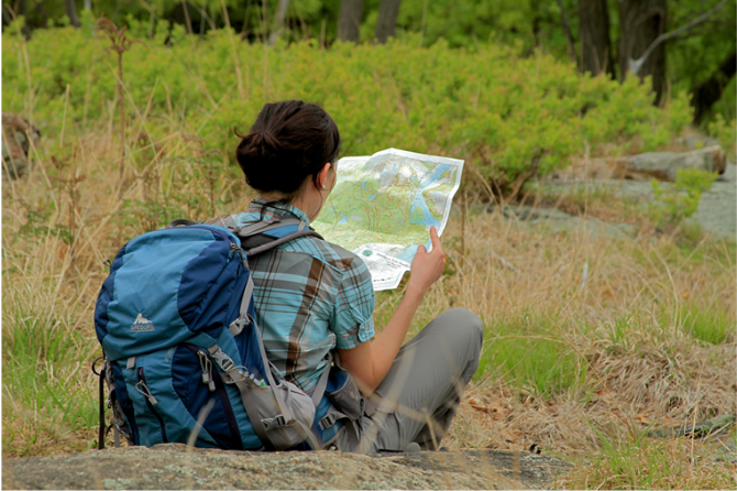
Map - Know where you are and where you are going. Many of our hiking areas feature interconnecting network of trails. Use a waterproof/tear-resistant Tyvek Trail Conference map if available or enclose your map in a Ziplock plastic bag. If you have a mobile device, download Avenza’s free PDF Maps app and grab some GPS-enhanced Trail Conference maps (a backup Tyvek or paper version of the map is good to have just in case your batteries die or you don't have service). Check out some map-reading basics here.
Food - Snacks/lunch will keep you going as you burn energy walking or climbing. Nuts, seeds, and chocolate are favorites on the trail.
Sunscreen and insect repellent
Rain Gear and Extra Clothing - Rain happens. So does cold. Be prepared for changing weather. Avoid cotton--it traps water against your skin and is slow to dry. If you are wearing wet cotton and must return to your starting point, you risk getting chills that may lead to a dangerous hypothermia. Choose synthetic shirts, sweaters and/or vests and dress in layers for easy on and off.
Compass - A simple compass is all you need to orient you and your map to magnetic north.
Light - A flashlight or small, lightweight headlamp will be welcome gear if you find yourself still on the trail when darkness falls. Check the batteries before you start out and have extras in your pack.
First Aid Kit - Keep it simple, compact, and weatherproof. Know how to use the basic components.
Firestarter and Matches - In an emergency, you may need to keep yourself or someone else warm until help arrives. A firestarter (this could be as simple as leftover birthday candles that are kept inside a waterproof container) and matches (again, make sure to keep them in a waterproof container) could save a life.
Knife or Multi-tool - You may need to cut a piece of moleskin to put over a blister, repair a piece of broken equipment, or solve some other unexpected problem.
Emergency Numbers - Know the emergency numbers for the area you're going to and realize that in many locations--especially mountainous ones, your phone will not get reception.
Common Sense - Pay attention to your environment, your energy, and the condition of your companions. Has the weather turned rainy? Is daylight fading? Did you drink all your water? Did your companion fail to bring rain gear? Are you getting tired? Keep in mind that until you turn around you are (typically) only half-way to completing your hike--you must still get back to where you started from! (Exceptions are loop hikes.)
Check the weather forecast before you head out. Know the rules and regulations of the area.
The Leave No Trace Seven Principles
Plan Ahead and Prepare
- Know the regulations and special concerns for the area you'll visit.
- Prepare for extreme weather, hazards, and emergencies.
- Schedule your trip to avoid times of high use.
- Visit in small groups when possible. Consider splitting larger groups into smaller groups.
- Repackage food to minimize waste.
- Use a map and compass to eliminate the use of marking paint, rock cairns or flagging.
Travel and Camp on Durable Surfaces
- Durable surfaces include established trails and campsites, rock, gravel, dry grasses or snow.
- Protect riparian areas by camping at least 200 feet from lakes and streams.
- Good campsites are found, not made. Altering a site is not necessary.
- In popular areas:
- Concentrate use on existing trails and campsites.
- Walk single file in the middle of the trail, even when wet or muddy.
- Keep campsites small. Focus activity in areas where vegetation is absent.
- In pristine areas:
- Disperse use to prevent the creation of campsites and trails.
- Avoid places where impacts are just beginning.
- Pack it in, pack it out. Inspect your campsite and rest areas for trash or spilled foods. Pack out all trash, leftover food and litter.
- Deposit solid human waste in catholes dug 6 to 8 inches deep, at least 200 feet from water, camp and trails. Cover and disguise the cathole when finished.
- Pack out toilet paper and hygiene products.
- To wash yourself or your dishes, carry water 200 feet away from streams or lakes and use small amounts of biodegradable soap. Scatter strained dishwater.
- Preserve the past: examine, but do not touch cultural or historic structures and artifacts.
- Leave rocks, plants and other natural objects as you find them.
- Avoid introducing or transporting non-native species.
- Do not build structures, furniture, or dig trenches.
- Campfires can cause lasting impacts to the backcountry. Use a lightweight stove for cooking and enjoy a candle lantern for light.
- Where fires are permitted, use established fire rings, fire pans, or mound fires.
- Keep fires small. Only use sticks from the ground that can be broken by hand.
- Burn all wood and coals to ash, put out campfires completely, then scatter cool ashes.
- Observe wildlife from a distance. Do not follow or approach them.
- Never feed animals. Feeding wildlife damages their health, alters natural behaviors, and exposes them to predators and other dangers.
- Protect wildlife and your food by storing rations and trash securely.
- Control pets at all times, or leave them at home.
- Avoid wildlife during sensitive times: mating, nesting, raising young, or winter.
Be Considerate of Other Visitors
- Respect other visitors and protect the quality of their experience.
- Be courteous. Yield to other users on the trail.
- Step to the downhill side of the trail when encountering pack stock.
- Take breaks and camp away from trails and other visitors.
- Let nature's sounds prevail. Avoid loud voices and noises.
The Trail Conference is a 2015 Leave No Trace partner.
(c) Leave No Trace Center for Outdoor Ethics: www.LNT.org.
Directions to Trailhead :
Take the New York State Thruway to Exit 15A. Turn left at the bottom of the ramp onto Route 17 and head north for 1.4 miles to the exit for Sterling Forest. Follow Sterling Mine Road (County Route 72) west for 2.4 miles, then turn right onto Long Meadow Road. Proceed past Old Forge Road and make the next right at a sign for "Laurel Meadow Pond." Proceed for 0.2 mile to a concrete parking area on the right side of the road, or to the second parking area on the right, with a dirt surface, and park in one of these parking areas.
TRAIN TRANSPORT :
Not availableBUS TRANSPORT :
Not availableShare Your Experience
SUPPORT
 Support the trails with a donation!
Trail Conference volunteers maintain trails in this hike.
Trip Reports
rate experience
No reviews for this hike, click above rate experience link to review this hike
Log in or register to post comments