This hike circles the Rocky Point area of the park. During World War II, this area was part of the Atlantic Coast Defense System, with concrete fortifications facing the ocean. The military abandoned the facility in the 1970s, and it is now a Monmouth County park, but many of the old fortifications still exist. You will have the opportunity to visit one of these fortifications at the end of...
Hike Description:
This hike circles the Rocky Point area of the park. During World War II, this area was part of the Atlantic Coast Defense System, with concrete fortifications facing the ocean. The military abandoned the facility in the 1970s, and it is now a Monmouth County park, but many of the old fortifications still exist. You will have the opportunity to visit one of these fortifications at the end of the hike.
Most trails in Hartshorne Woods Park (including those that make up this hike) are open to hikers, joggers, bicyclists and equestrians, and are often used by bicyclists (although not by equestrians). Although park regulations provide that bicyclists must yield to all other trail users, hikers should be alert for approaching bicycles on narrow trails. Hikers must yield to equestrians.
To begin the hike, return to the entrance to the parking area and turn right onto a gated but paved park service road. About 50 feet beyond the gate, you will see a signpost on the left marking the start of the Rocky Point Trail. The park has designated this trail with a black diamond, indicating that it is rated as “challenging”; however, the rating system is designed primarily with bicyclists in mind. For hikers, the trail is of no more than moderate difficulty.
The Rocky Point Trail begins by descending on a winding path through stands of holly to cross a bridge over a stream. It continues through dense vegetation. About half a mile from the start, the trail approaches the Shrewsbury River, with homes on the Sea Bright peninsula visible through the trees across the river.
The trail continues ahead, parallel to the river below to the left, soon reaching a paved service road. To the left, the road leads in 250 feet to a grassy area with picnic tables overlooking the confluence of the Shrewsbury and Navesink rivers – a good place for a break.
Continue ahead on the Rocky Point Trail, which now parallels the Navesink River and begins to climb. At the top of the rise, you’ll notice some ivy-covered trees on the right. The trail descends past a dense stand of holly to reach another paved service road. To the left, this road leads downhill a short distance to the Black Fish Cove fishing pier, with excellent views over Navesink River (there are also picnic tables and a privy here). The Rocky Point Trail turns right, follows the service road for 50 feet, then turns left and reenters the woods.
The trail descends to cross a footbridge over a small stream, climbs gradually, then levels off. About half a mile from the second service road crossing, it ascends quite steeply. At the top of the climb, where the main trail turns sharply right, follow an unmarked side trail which continues ahead to a limited viewpoint over the Navesink River, with the view largely obscured by the trees. From the viewpoint (shown on the park map as the "Navesink Overlook"), return to the main trail by following a path that heads northeast, then turn left onto the Rocky Point Trail.
The Rocky Point Trail now begins a gradual descent, passing through some dense stands of mountain laurel. About two miles from the start, it crosses another paved service road (to the left, this road leads to an abandoned bunker). The trail now climbs through holly and mountain laurel to cross a small bridge. It descends briefly, continues through dense holly trees, then climbs on switchbacks to reach yet another paved service road – this one marked by two concrete pillars on the left.
Cross the road, then immediately bear right onto a path that heads uphill. You’ll soon reach the crest of the rise and descend to a gravel fire road – the route of the Cuesta Ridge Trail. (Take the right fork just before reaching this junction.) Turn right onto the Cuesta Ridge Trail, then immediately bear right at the next fork. Soon, you’ll reach a paved service road. Turn left on the road, then bear right at the next fork and climb a grassy slope to return to the parking area, which is just ahead.
You might also want to visit Battery Lewis – a large concrete fortification overlooking the ocean, built in 1942. This interesting feature, which features a 168-foot-long, 16-inch caliber gun, is just beyond the parking area, on the left. Interpretive signs explain how and why this imposing fortification was constructed during World War II.
Publication: Submitted by Daniel Chazin on 11/20/2003 updated/verified on 02/12/2023

This hike loops around the Rocky Point section of the park, passing several viewpoints over the Shrewsbury and Navesink Rivers.
40.390456, -73.988921
Monmouth Co., NJ
3 mi
2 hrs

Web Map: Hartshorne Woods Park
Hike Checklist:
Whether you are going for a day hike or backpacking overnight, it is good practice to carry what we call The Hiking Essentials. These essentials will help you enjoy your outing more and will provide basic safety gear if needed. There may also be more essentials, depending on the season and your needs.
The Essentials
Hiking Shoes or Boots
Water - Two quarts per person is recommended in every season. Keep in mind that fluid loss is heightened in winter as well as summer. Don't put yourself in the position of having to end your hike early because you have run out of water.
Map - Know where you are and where you are going. Many of our hiking areas feature interconnecting network of trails. Use a waterproof/tear-resistant Tyvek Trail Conference map if available or enclose your map in a Ziplock plastic bag. If you have a mobile device, download Avenza’s free PDF Maps app and grab some GPS-enhanced Trail Conference maps (a backup Tyvek or paper version of the map is good to have just in case your batteries die or you don't have service). Check out some map-reading basics here.
Food - Snacks/lunch will keep you going as you burn energy walking or climbing. Nuts, seeds, and chocolate are favorites on the trail.
Sunscreen and insect repellent
Rain Gear and Extra Clothing - Rain happens. So does cold. Be prepared for changing weather. Avoid cotton--it traps water against your skin and is slow to dry. If you are wearing wet cotton and must return to your starting point, you risk getting chills that may lead to a dangerous hypothermia. Choose synthetic shirts, sweaters and/or vests and dress in layers for easy on and off.
Compass - A simple compass is all you need to orient you and your map to magnetic north.
Light - A flashlight or small, lightweight headlamp will be welcome gear if you find yourself still on the trail when darkness falls. Check the batteries before you start out and have extras in your pack.
First Aid Kit - Keep it simple, compact, and weatherproof. Know how to use the basic components.
Firestarter and Matches - In an emergency, you may need to keep yourself or someone else warm until help arrives. A firestarter (this could be as simple as leftover birthday candles that are kept inside a waterproof container) and matches (again, make sure to keep them in a waterproof container) could save a life.
Knife or Multi-tool - You may need to cut a piece of moleskin to put over a blister, repair a piece of broken equipment, or solve some other unexpected problem.
Emergency Numbers - Know the emergency numbers for the area you're going to and realize that in many locations--especially mountainous ones, your phone will not get reception.
Common Sense - Pay attention to your environment, your energy, and the condition of your companions. Has the weather turned rainy? Is daylight fading? Did you drink all your water? Did your companion fail to bring rain gear? Are you getting tired? Keep in mind that until you turn around you are (typically) only half-way to completing your hike--you must still get back to where you started from! (Exceptions are loop hikes.)
Check the weather forecast before you head out. Know the rules and regulations of the area.
The Leave No Trace Seven Principles
Plan Ahead and Prepare
- Know the regulations and special concerns for the area you'll visit.
- Prepare for extreme weather, hazards, and emergencies.
- Schedule your trip to avoid times of high use.
- Visit in small groups when possible. Consider splitting larger groups into smaller groups.
- Repackage food to minimize waste.
- Use a map and compass to eliminate the use of marking paint, rock cairns or flagging.
Travel and Camp on Durable Surfaces
- Durable surfaces include established trails and campsites, rock, gravel, dry grasses or snow.
- Protect riparian areas by camping at least 200 feet from lakes and streams.
- Good campsites are found, not made. Altering a site is not necessary.
- In popular areas:
- Concentrate use on existing trails and campsites.
- Walk single file in the middle of the trail, even when wet or muddy.
- Keep campsites small. Focus activity in areas where vegetation is absent.
- In pristine areas:
- Disperse use to prevent the creation of campsites and trails.
- Avoid places where impacts are just beginning.
- Pack it in, pack it out. Inspect your campsite and rest areas for trash or spilled foods. Pack out all trash, leftover food and litter.
- Deposit solid human waste in catholes dug 6 to 8 inches deep, at least 200 feet from water, camp and trails. Cover and disguise the cathole when finished.
- Pack out toilet paper and hygiene products.
- To wash yourself or your dishes, carry water 200 feet away from streams or lakes and use small amounts of biodegradable soap. Scatter strained dishwater.
- Preserve the past: examine, but do not touch cultural or historic structures and artifacts.
- Leave rocks, plants and other natural objects as you find them.
- Avoid introducing or transporting non-native species.
- Do not build structures, furniture, or dig trenches.
- Campfires can cause lasting impacts to the backcountry. Use a lightweight stove for cooking and enjoy a candle lantern for light.
- Where fires are permitted, use established fire rings, fire pans, or mound fires.
- Keep fires small. Only use sticks from the ground that can be broken by hand.
- Burn all wood and coals to ash, put out campfires completely, then scatter cool ashes.
- Observe wildlife from a distance. Do not follow or approach them.
- Never feed animals. Feeding wildlife damages their health, alters natural behaviors, and exposes them to predators and other dangers.
- Protect wildlife and your food by storing rations and trash securely.
- Control pets at all times, or leave them at home.
- Avoid wildlife during sensitive times: mating, nesting, raising young, or winter.
Be Considerate of Other Visitors
- Respect other visitors and protect the quality of their experience.
- Be courteous. Yield to other users on the trail.
- Step to the downhill side of the trail when encountering pack stock.
- Take breaks and camp away from trails and other visitors.
- Let nature's sounds prevail. Avoid loud voices and noises.
The Trail Conference is a 2015 Leave No Trace partner.
(c) Leave No Trace Center for Outdoor Ethics: www.LNT.org.
Directions to Trailhead :
Take the Garden State Parkway south to Exit 117. Bear left beyond the toll booths and continue on NJ 36 for 12.3 miles. Just before the Highlands-Sea Bright bridge, turn right at a sign for "Bay Avenue/Highlands." Continue ahead on Portland Road for 0.8 mile to the park entrance, which is straight ahead where the road curves very sharply to the right.
TRAIN TRANSPORT :
Not availableBUS TRANSPORT :
Not available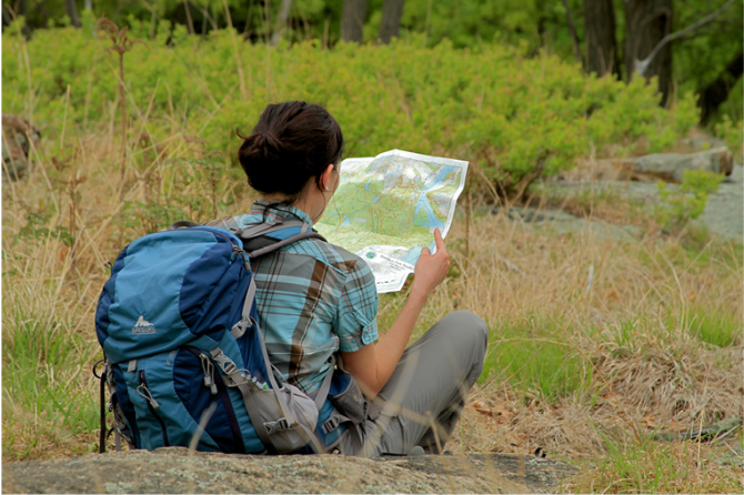
 Support the trails with a donation!
Trip Reports
rate experience
No reviews for this hike, click above rate experience link to review this hike
Log in or register to post comments